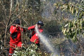
NOAA Satellite Detects 18 Forest Fire Hotspots Across Sumatra

Pekanbaru, Riau, (Antarariau.com) - The US National Oceanic and Atmospheric Administration (NOAA) 18 satellite operated by Singapore detected 18 hotspots of forest and plantation fires across Sumatra Island on Saturday.
"So far, the number of hotspots is not worrying, however, we should remain watchful," Said Saqlul Amri, the head of the Riau disaster mitigation office (BPBD) said in a statement on Sunday.
Of the total 18 hotspots, four were found in Rokan Hilir District in Riau Province, he said.
In Rokan Hilir, two hotspots were located in Sungai Sigajah village, Kubu subdistrict, one in Balam Sempurna, Bagan Sinembah subdistrict, and another in Sungai Daun village, Pasir Limau Kapas subdistrict.
The number of hotspots in Riau on Saturday was significantly dropped from that on the previous day.
"Yesterday, more than 10 hotspots were detected in Riau alone. The gutted land areas produced smoke," he stated.
The Riau administration has extended the haze emergency status until November 30, 2014, Riau Provincial Police Chief Brigadier General Condro Kirono said.
The decision to extend the emergency status that began on June 23, was based on report issued by the presidential working unit on monitoring and control (UKP4) which said the potential of El-Nino phenomena to develop was more than 60 percent and would tend to be high until early 2015.
This year, El-Nino is predicted to trigger drought and forest fires which could be worse than those in 2013. El-Nino-induced drought would be felt starting July and would tend to get stronger after November 2014.
During June 2014 alone, at least 341 hectares of forest and plantation areas in Riau were gutted by fires.
The largest loss caused by forest and land fires in Indonesia occurred in 1997, when fires wiped out millions of hectares of forest and plantation areas and caused losses worth US$2.45 billion.
During 1997-1998, Indonesia experienced a prolonged drought induced by the strongest ever recorded El Niño, which triggered widespread fires.
Pewarta : Antara Riau
Editor:
COPYRIGHT © ANTARA 2026


